About MUFUMBWE COPPER PROJECT
Project Description
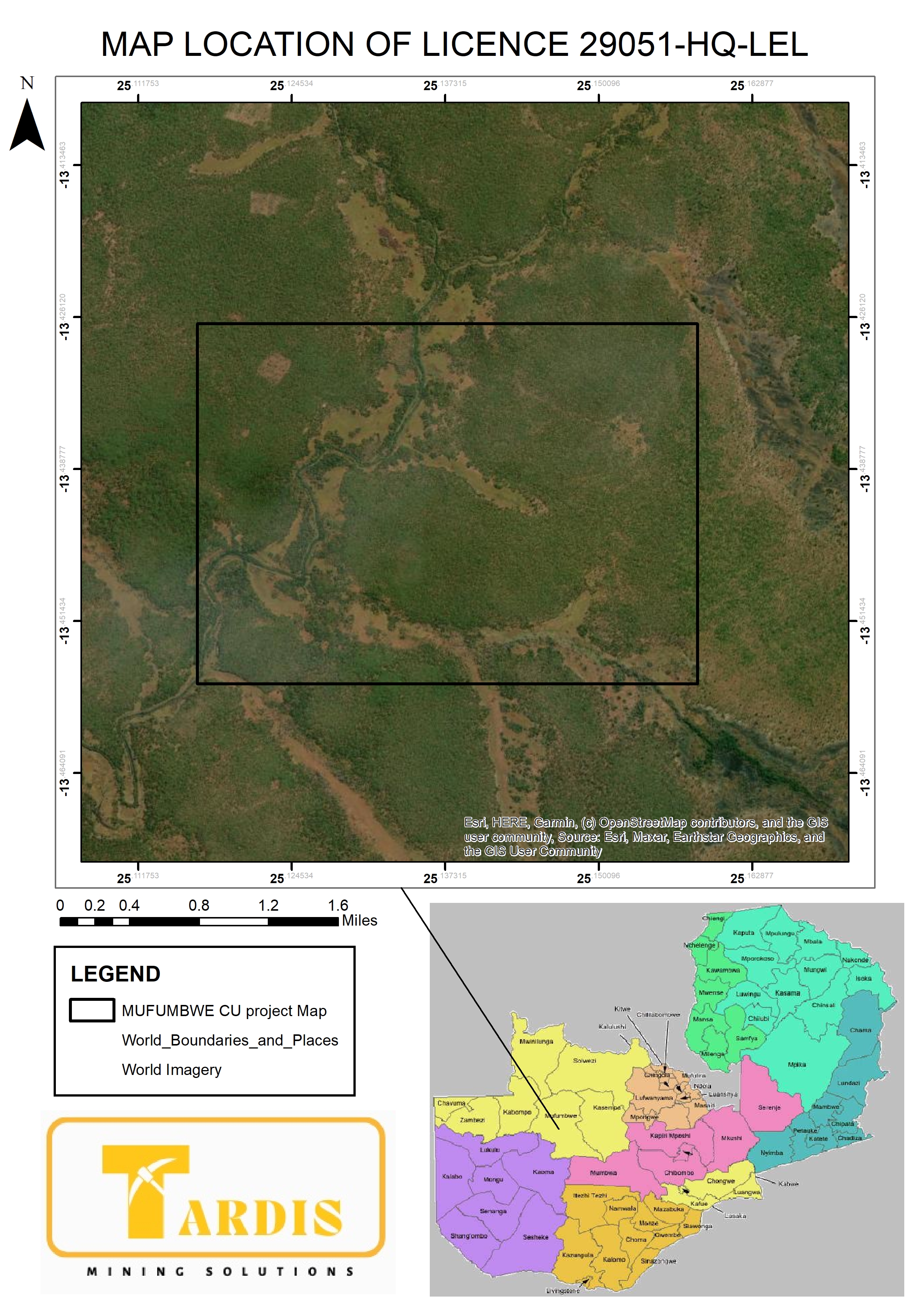
Quick Copper Mining Limited holds Large-Scale Exploration Licence No. 29051-HQ-LEL. The licence was applied for on 5 May 2021, granted on 17 June 2021 and is valid until 16 June 2028. The tenement covers approximately 1,497.78 hectares in Mufumbwe District, North-Western Province, and targets cobalt, copper, gold and iron ore. Quick Copper is advancing an early-stage copper exploration programme. The licence lies close to the Euro Kalengwa copper deposit, enhancing its prospectivity. Work to date includes soil geochemical sampling (185 samples), a ground magnetic survey and three shallow test boreholes. The programme identified three copper anomalies, the largest measuring about 1.3 × 1.0 km in the north-west. One borehole returned 500–600 ppm Cu before being terminated early, while the others returned 150–350 ppm Cu, confirming copper mineralisation and supporting further work. The licence renewal was approved at the 91st Mining Licensing Committee meeting on 8 October 2025. Quick Copper has engaged Tardis Mining Solutions to surrender the licence for endorsement by the Mining Cadastre Department so that the new expiry date may be recorded.
Project History
Licence No. 29051-HQ-LEL was granted to Quick Copper Mining Limited on 17th June 2021, together with the official mining licence certificate. To commence exploration operations, the company engaged Tardis Mining Solutions to provide technical support in line with regulatory and operational requirements. As part of the initial groundwork, pegging of the licence area was successfully completed, ensuring compliance with statutory procedures and laying the foundation for subsequent exploration activities.

Gallery
Survey
SOIL SAMPLING SURVEY
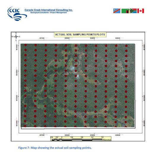
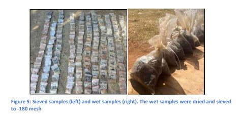
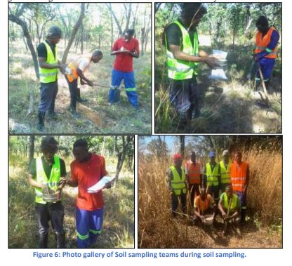
Soil sampling program commenced on 30th May, 2023 and ended on 3rd June, 2023. Daily traverses were done from mufumbwe to the grid covering a distance of about 130km to and from for 5 day. The datum system used is Arc 1950 and all measurements were in SI units, two hand held GPS were used during soil sampling works by two sampling crews. Samples wee sieved to -180 mesh size were the sampling interval was 200m x 400m line spacing and sample spacing designed or oriented in the North-South direction. A total of 11 sampling lines were designed, each line had 17 samples that was sampled sieved and bagged. A total of 187 samples was to be located within license 29051-HQ-LEL and only two samples wee not collected because the sampling points were failing in water that tells that only 185 samples were collected. A total of 37.4km was traversed by the sampling crews during soil sampling, each line was 3.4km long running from south to the North the QAQC ( duplicates, standards and blanks) account for about 5% of the Data collected. Total number of samples collected was 185 , 4 standard samples, 2 blank samples and 5 duplicate samples which reaches to Total sample submitted for analysis to be 197 samples.
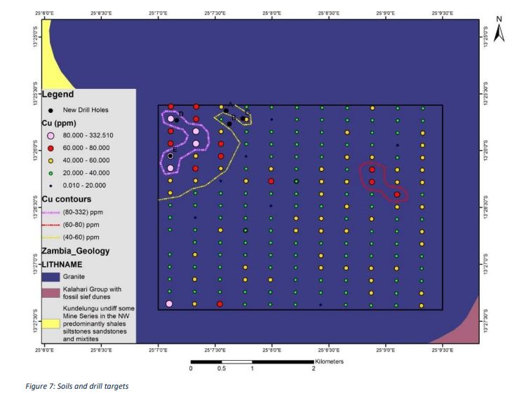
SOIL SAMPLING POINTS AND SAMPLES
SOIL SAMPLING SURVEY
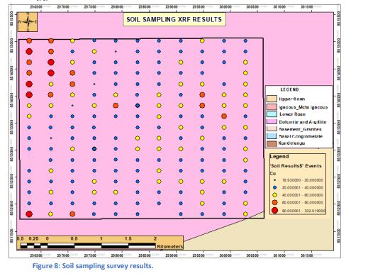
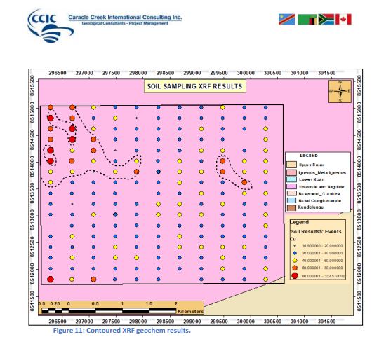
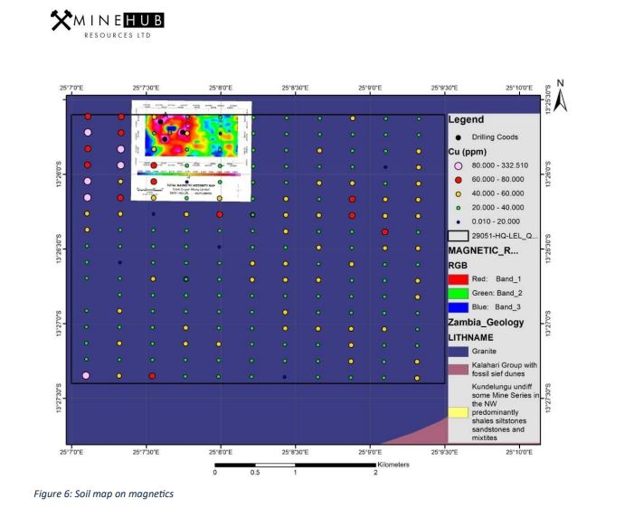
Quick Copper Mine Limited carried out a soil sampling programme to identify copper anomalies and generate potential drill targets within the licence area. A total of 187 sampling points were planned, with 185 samples successfully collected; the remaining two points could not be sampled due to water cover. The survey covered approximately 37.4 km, using a grid pattern of 200 m spacing along north-south oriented lines across 11 traverses, each comprising 17 sampling points. All collected samples were dried, sieved, and analysed for copper content. The results revealed three main copper anomalies located in the north-western, eastern-central, and southern parts of the licence. Among these, the north-western anomaly, covering approximately 1.3 km by 1.0 km, emerged as the most significant, with copper values reaching up to 300 ppm, suggesting strong potential for mineralisation in that part of the licence area.
Soil sampling fieldwork supported by detailed maps showing sampling points and copper anomaly locations.

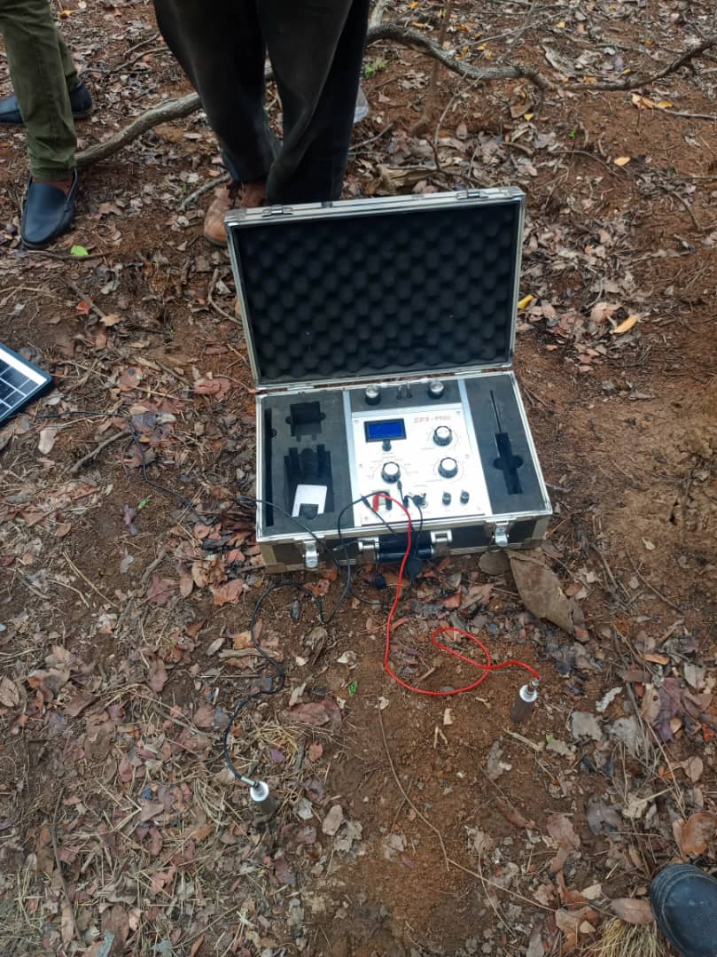
MAGNETIC SURVEY PROGRAMME
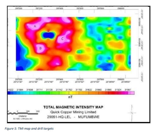
A magnetic survey was undertaken to refine drilling targets within the licence area, with a focus on the major copper anomaly identified in the north-western portion. The survey was conducted on 100 metre line spacing and comprised 26 magnetic lines across the target zone. This work corresponded with the previously defined north-western soil anomaly, which had shown the strongest copper response. Based on the magnetic results, three drill targets designated A, B, and C were planned within this anomaly to assess its mineral potential. While the localised survey delivered valuable structural and lithological insights, a comprehensive magnetic survey over the entire licence area is still required to delineate additional targets and geological structures.
Maps illustrating the magnetic survey coverage and target zones within the licence area

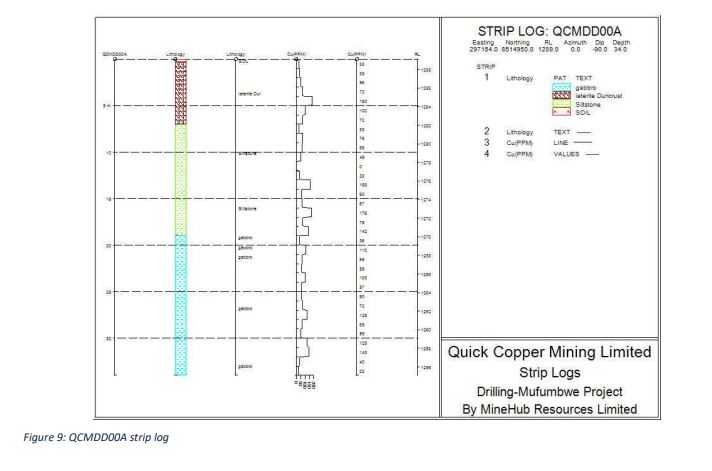
TEST DRILLING PROGRAMME
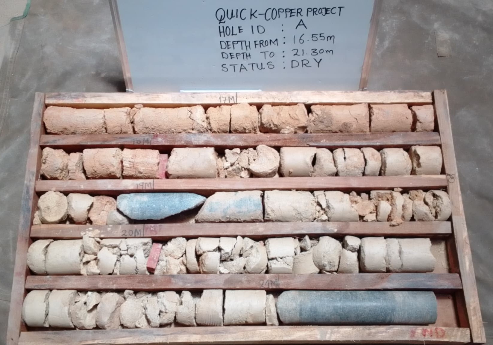
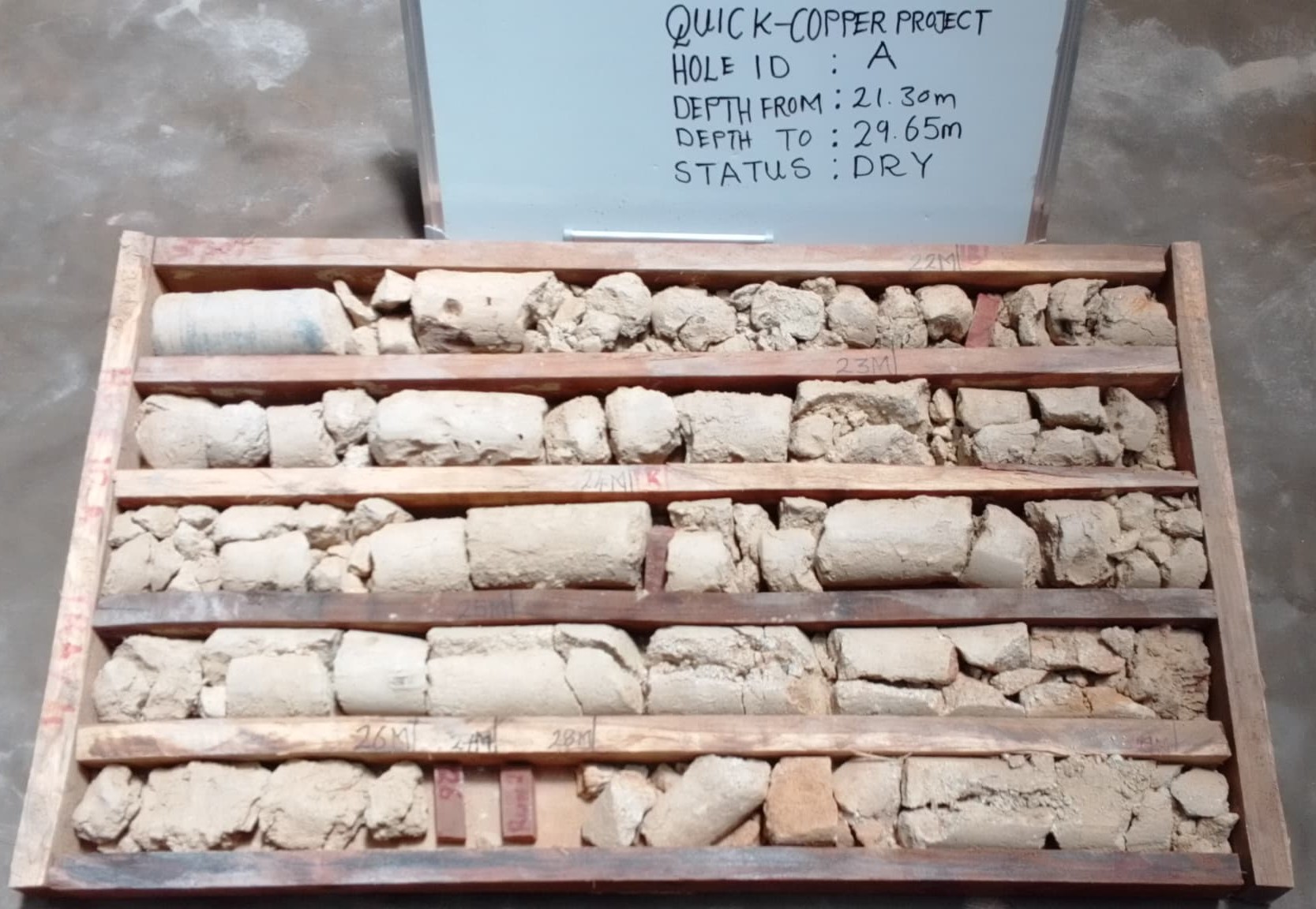
Quick Copper Mining Limited undertook a preliminary test drilling programme using a cost-effective geotechnical rig to validate Geochemical anomalies identified through prior soil sampling. Three boreholes were drilled to depths of approximately 30 metres. 1. QCMDD00A (north of the licence boundary): Drilled to 34 metres, recording copper concentrations of 150 - 200 ppm within siltstone. 2. QCMDD00D (north-western boundary): Returned the highest values of 500 - 600 ppm but was prematurely terminated, indicating potential for further mineralisation at depth. 3. QCMDD00D (north-eastern boundary): Recorded copper values up to 350 ppm within the first 7 metres. The drilling results correlate strongly with soil anomalies and confirm the presence of copper mineralisation within the license area. These findings justify more advanced drilling to better define the subsurface potential.
Map indicating drill hole locations, with images of cores and on-site drilling.